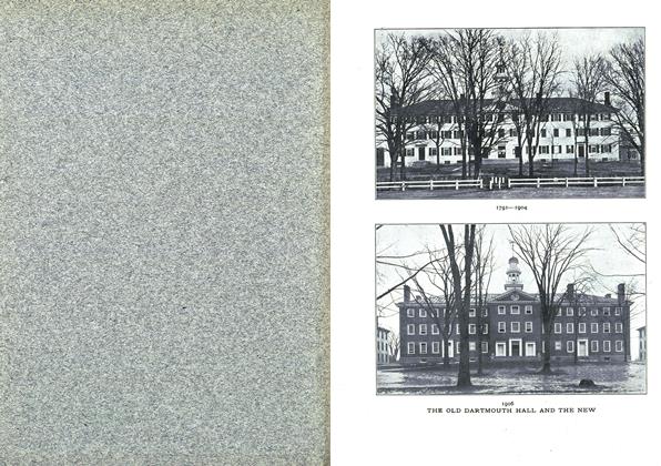
MAP OF HANOVER
A complete and very informing map of Hanover has recently been published. It shows all the buildings and principal features of the region, extending from the foot of Sand Hill on the southeast to Occom Pond on the north, and from Mr. C. C. Ward's house on the east to the railroad station on the west. In Norwich the west side of the Connecticut is mapped from Lewiston to the sawmill. Parallel lines running true north and south and east and west indicate correct distances from an origin at the observatory, from 2200 ft. north to 2600 ft. south, and from 1200 ft. east to 4400 ft. west. There is a full directory of public buildings, College buildings, business places, dwellings, and residences, by streets and house numbers. Elevations above sea level are shown by contours. Interesting information is given concerning the water works, the Connecticut River and points of historical interest. The very beginning of Hanover is shown by the indicated locations of the first buildings which President Wheelock caused to be erected before 1774. There is a map on a reduced scale of Hanover 50 years ago, with the names of residents at that time. The material of the buildings, whether wood or masonry, and also the material of roofs, whether shingle or slate or metal, are shown by methods of delineation.
This map is the product of surveys during the past ten years by classes of the Thayer School of Civil Engineering, under charge of the Director, Robert Fletcher, and his associates, Professors French, Mann, and Holden. It is photolithographed from the original (scale of 100 ft. to the inch) by Geo. H. Walker & Co. of Boston. It is for sale at Storrs'bookstore for 50 cts., or by sending price direct to Professor Fletcher or Professor Holden. It is copyrighted by the Thayer School of Civil Engineering, and the proceeds of sales, if more than enough to cover the very considerable cost of production, will be devoted to the equipment fund of that institution.
It may be interesting to note that at the time of the visit of the Earl of Dartmouth, Professor Holden made measurements which approximately located the old governor's lot of 500 acres, the northeast corner being, as was supposed, east of the big barn; the east line was believed to be very nearly located.
More From This Issue
-
 Article
THE ADMINISTRATION OF THE MODERN COLLEGE*
February 1906 -
 Article
THE practical workings of the preceptorial system
February 1906 -
 Article
PRECEPTORIAL INSTRUCTION AT PRINCETON
February 1906 -
 Article
THE RHODES SCHOLARSHIPS
February 1906 -
 Article
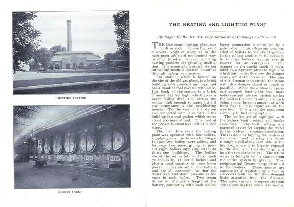
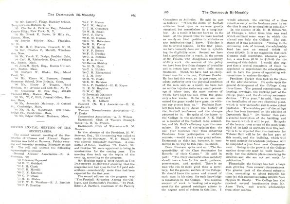
THE HEATING AND LIGHTING PLANT
February 1906 -
 Class Notes
SECOND ANNUAL MEETING OF THE SECRETARIES.
February 1906