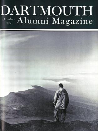
Dartmouth's Highest Classroom
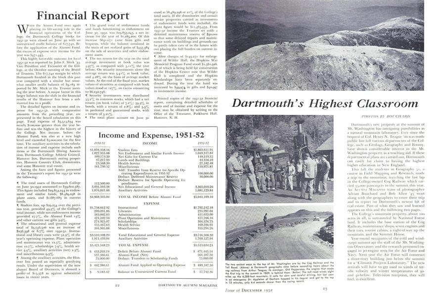
Dartmouth's new property at the summit of Mt. Washington has intriguing possibilities as a natural mountain laboratory. Ever since the bequest of Col. Henry N. Teague 'oo was made public last fall various departments of the College, such as Geology, Geography and Botany, have shown considerable interest in the Mt. Washington property as a teaching aid. If these departmental plans are carried out, Dartmouth can easily lay claim to having the highest higher education in New England.
This fall the students in Geography 51, a course in Field Mapping and Research, made a trip to the mountain, traveling the last lap in the College-owned Cog Railway which carried 35,000 passengers to the summit this year. An AI.UMNI MAGAZINE team of photographer Adrian Bouchard and Bob Allen '45 went along with the geographers to cover their trip and to report on Dartmouth's newest bit of real estate. Part of what they saw and learned appears on this and the following two pages.
The College's mountain property, about 100 acres in all, is surrounded by National Forest land. It includes the base station of the Cog Railway, maintenance shops, seven engines and their cars, tourist cabins, a right-of-way up the mountain, and the Summit House.
Year-round occupants of the cold and windswept summit are the staff of the Mt. Washington Observatory and the research personnel engaged in jet-engine tests for the Air Force and Navy. Next year the Air Force will construct a three-story building just below the summit for a "Climatic Projects Laboratory." The new arrivals will have to get used to winds of terrific velocity and winter temperatures of 30-and 40-below. Television reception, they will find, is excellent.
The two easiest ways to the top of Mt. Washington are by the Cog Railway and the Toll Road. (Above) A Dartmouth geography class before ascending hears about cog railway from Arthur Teague, its manager. Old Peppersass engine that made the first trip to the summit in 1869, is behind them. (Below) The toll road w, eight miles up the 6,288-foot mountain. It calls far slow and careful driving, but last year in an emergency Dr. Appleton of Gorham hopped in i.s Jaguar and got to the top in 13 minutes, only 6.4 seconds slower than the racing record.
A close-up aerial view of the buildings grouped at the summit of Mt. Washington. At the left is the Mt. Washington Observatory and the FM tower that can be seen from the base station on a clear day. Near the observatory are the Yankee Network building, top, and the old Stage House. To the right is the long Summit House and behind it the old Tip Top House. Lower down, at the terminus of the Toll Road, is the building where iet-engine tests are now being conducted.
Arthur Teague (left), who manages the Cog Railway and Summit House for the College, shown at the Fabyan base station with Robert L. Allen '45, who accompanied Photographer Adrian Bouchard on the Mt. Washington trip this fall and assembled most of the facts and figures presented with these pictures.
The Summit House, which can accomodate 100 people overnight, charges more for rooms on the sunrise side (seen in picture) than for those on the sunset side. Each room now has running water thanks to a pumping system, devised by Arthur Teague, that pumps water ail the way from the base station.
The Mt. Washington Observatory and the FM mast that has become a summit landmark. To the left is the plant which generates electric power for the summit buildings at 15 cents a kilowatt hour. Although comparatively new, the frame building which now houses the observatory is already weathered beyond its years.
The brass circle embedded in rock is the U. S. Geological Survey marker indicating the exact summit of the mountain, 6,288 feet above sea level. This is the highest point in New England. The cat in the background is the pet of the observatory staff and adds one homey touch to the bleak and rocky scene.
Prof. Albert S. Carlson of Dartmouth's Geography Department lectures to his class on the edge of the great gulf south of the summit. Right behind him is a drop of 1500 feet. The field trip by the class in Field Mapping and Research was one of the first educational uses of the summit since the College acquired it.
Jutting out like the prow of a ship is the west end of "Tip Top," the old summit hotel, whose main building is the oldest structure now atop Mt. Washington. This newer end was added to house some armed forces experiments of several years ago. "Tip Top" is used as living quarters for hotel personnel and others during the summer season.
The Yankee Network Building, completed in 1932, is reputed to have cost $250,000. It was originally designed as an FM transmitter but is not flow in use by the network. Leased to the Air Force, the building provides living quarters for the personnel working on the jet-engine testing project. To this group the summit is known as "The Rockpile."
Winds that reached a velocity of 234 miles an hour in 1934 require that all summit buildings be securely anchored. The old Stage House, shown here, is chained to its rock foundation. Now little used, the Stage House is owned by private Toll Road interests and was formerly occupied by their caretaker and repair man.
Richard B. Learnard '28 (right), chief observer at the Mt. Washington Observatory, is shown explaining the operations of the station to Dartmouth geography students. The building is framed with 9 x 10 timbers and is bolted into a concrete foundation by steel rods. A cowbell on the kitchen wall starts jangling when the wind reaches 100 miles an hour.
Known as The.Hangar, this is the site of jet-engine tests conducted by civilian contractors for the Navy and the Air Force's Research and Development Command. The jet intake (right) faces the prevailing wind. Aircraft engines are tested here for endurance and serviceability, especially in the extreme low temperatures of the winter.