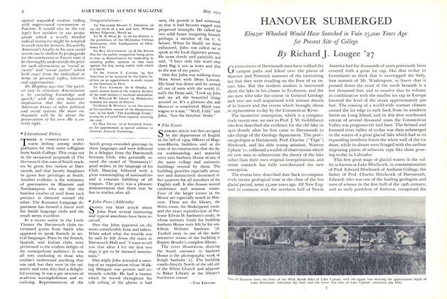
Hanover in the Ice Age
A story of geological research, involving a mystery stretching back to the era when the campus for 600 years was at the bottom of a glacial lake
I IKE the terraces of an artificial garden" wrote Jeremy Belknap in describing the borderlands of the Connecticut River in 1792. The expression of wonder by New Hampshire's ancient historian was directed at the conspicuous flat surfaces which are separated from one another by steep escarpments facing the river along its 300-mile course from Canada to Long Island Sound. The terraces still fascinate visitors to the Connecticut Valley. On their surfaces are located many a town and college campus from Hanover to Middletown, with notable examples at Amherst, Northampton and Mount Holyoke, so it is natural that much of the research into their origin has been clone by teachers and students in these New England centers of learning.
Perhaps the Earliest recorded investigation was in 1818 when Edward Hitchcock, then a 25-year old principal of Deerfield Academy - later to become a president of Amherst, as well as the first State Geologist of Massachusetts - examined the clayey strata of the lowlands bordering the Connecticut River. He concluded that such fine textured material could only have settled in the quiet waters of a lake. This judgment was correct, and undoubtedly it influenced the opinions of his son, Charles, who became Dartmouth's well-known geology professor, better known as "Type" Hitchcock. Unlike his father, Charles became converted to Louis Agassiz' theory of Continental Glaciation, formulated in 1840. In fact Charles, in 1868, was first to bring to scientific notice the novel fact that a great ridge forming the backbone of Long Island is the terminal moraine of the ice cap that spread over New England.
After coming to Dartmouth to teach in 1868, Charles Hitchcock organized the geological survey of the State of New Hampshire. Study of the surface deposits he assigned to one of his students, Warren Upham, of the Class of 1871, destined to become one of the greatest minds in glaciological research in America. Upham, an energetic little man, who later became an authority on the extinct Glacial Lake Agassiz in the Red River Valley of the Dakotas and Minnesota, devoted several seasons to the survey of the terraces of "modified drift" as he called the sands, clays, and gravels in the New Hampshire valleys. Using a flat boat, and basing his measurements on engineers' profiles of the river, he ran levels to all the principal terraces on the Connecticut and other large rivers of New Hampshire. His contribution to Hitchcock's three-volume State Geological Report in 1878 remains the standard work on Connecticut Valley terraces north of Massachusetts, and is remarkable for the detailed maps made by Upham before government topographic surveys were instituted.
Upham discovered a great ridge of gravel, 24 miles long, more or less buried in the clay deposits, extending from Windsor, Vermont, northward through Hanover to a point where, for reasons that he did not understand, it terminated abruptly at Thetford and Lyme. This "esker," so-called, which is well known to Dartmouth men as "Occom Ridge," Upham believed had been formed in flood waters from the ice sheet as it melted away northward. Silt and clay deposits which he attributed to the supposed flood, he correctly showed had once formed a continuous deposit filling the valley to the level of the Hanover clay plain on which the Dartmouth campus is located. The upper limit of flood waters he considered to be marked by still higher "delta terraces," such as Sand Hill which overlooks Hanover on the turn of the road leading out of town on the way to Lebanon. Upham thought the slope of the flood down the valley was indicated by the declining elevations of delta terraces southward, amounting to four feet per mile. It is now known that no flood with the height and magnitude that he imagined could have been long maintained on so steep a slope.
James D. Dana, a Yale geologist of that period, who also had a glacial flood theory for the Connecticut Valley, disclaimed the existence of Upham's esker, and could not be convinced of another discovery made by Upham that the Hanover clay plain terrace abruptly declines ninety feet in elevation north of Thetford and Lyme. Upham had detected this strange step in the profile of the clay plain, exactly coinciding with the northern termination of his esker. To explain it he could only suggest that the rate of melting of ice rapidly increased from Lyme northward.
A number of these mysteries were clarified when Professor James Walter Goldthwait came to Hanover on the retirement of Professor Hitchcock. Goldthwait was experienced in problems of this kind elsewhere in New England and in the Great Lakes where he had surveyed glacial shorelines. He recognized that the northward increase in elevation of delta terraces has been caused by a continental land movement which has lifted and tilted New England highest toward the northwest. Upham reported evidence for these great crustal movements in his classic account of the Glacial Lake Agassiz in 1896, but he never renewed his Connecticut Valley studies, and it remained for Goldthwait in 1910 to make the first pronouncement that the upper Connecticut Valley is the highly tilted basin of a former glacial lake.
Goldthwait's views received convincing consignation from the investigations of a Swedish geologist, Ernst Antevs, whose researches in the Connecticut Valley in 1921 made use of techniques developed by his famous teacher, Professor Gerard DeGeer of Stockholm. It had been discovered by DeGeer, working in the Baltic Basin, that the banded glacial clays, or "varved clays" as he called them, are annual in character. They are fine sediments which settled in the deep quiet water of glacial lakes, although they had their source in the same subglacial rivers which built up gravel under water to form eskers. By their differing thicknesses the clay layers register the varying temperatures of successive years of summer melting of the ice cap - a fact that allows carefully measured clay sections miles apart to be graphed, and the graphs correlated. Antevs demonstrated the DeGeer principles by measuring scores of sections in clay banks from Hartford, Connecticut, to St. Johnsbury, Vermont, from which he was able to construct a chronology of some 4000 consecutive years. He proved that the varves overlap northward toward the retiring ice border. Exposures of the bottom varves at a number of localities allowed him to determine the year the ice uncovered these localities, and from this he calculated how fast the ice melted away northward in feet per mile - an amount averaging 700 feet per year at Hanover.
IT was at this stage of general information that the writer was introduced to Connecticut Valley problems in Professor Goldthwait's classes in 1925-26; and after graduation in 1927, while teaching in the Geology Department, he made a survey of the delta terraces north and south of Hanover using an aneroid barometer. Professor Goldthwait indoctrinated his students well in the lore of the terraces, the highest of which are deltas along the lake shore, the next lower are clay plain or lake floor, and lower still are the stream terraces carved out of the lake floor by the post-glacial river. Weekend field trips were made with the professor in a Model T Ford in spring and fall, in the course of which the exposed sections of varved clay around Hanover were remeasured and compared with Antevs' accurate clay chronology. Yet for unaccountable reasons the deltas north of Hanover would not line up with those to the south.
There also appeared to have been a great disturbance in the clay sedimentation at Hanover. Signs of this are a sandy varve, 21 feet thick where exposed in a high bluff on Mink Brook but decreasing to two or three feet where it underlies the entire Dartmouth campus. Below this unusual layer there are about fifty varves down to the bottom where the clay rests either on glacial "till" or on the esker. Bottom varves on the esker have a thickness of five or six feet, but thicknesses decrease upward to one or two inches in the varves just beneath the great sandy layer. The reduction in thickness reflects an increase in distance to the source of clay-silt supply as the ice border retreated northward. Above the great sandy layer there are about 600 little varves, representing as many years, which terminate upward at the surface of the Hanover clay plain. What had created the disturbance and caused fine sand to be spread over all the lake floor in a particular year fifty years after the ice uncovered Hanover, was a mystery which I remember Professor Goldthwait and I were discussing when we were photographed together in the accompanying illustration.
In 1928-29 I attended the University of Michigan on Professor Goldthwait's advice, to begin graduate studies. One night while working in my office in Ann Arbor in early December 1928 I was thumbing through Antevs' varved clay report when I was attracted to the description of a section of 72 varves overlying till at West Lebanon, four miles south of Hanover. The uppermost fifty varves of this section were described as matching the varves under the great sandy layer at Hanover - a fact that no one had noticed before - the other lower 22 varves representing years of ice recession from West Lebanon to Hanover. Since the sedimentary record concluded abruptly to form an original surface of lake floor, I concluded right away that the lake waters must have been drained suddenly from above the clays at West Lebanon. On the other hand, after a presumably similar lowering of water level at Hanover, recorded by the spreading of sand from the mouths of rejuvenated tributary streams like Mink Brook, there must have been sufficient depth of water left above the Hanover plain to preserve a lake there for at least 600 years.
The surprising character of this discovery prompted a return trip back east next day on the Wolverine, cutting the last week of classes before Christmas vacation, and bringing me post haste to the Dartmouth campus where an explanation of my unexpected appearance created the greatest excitement and ready support from Professor Goldthwait. In the next few days prior to -freeze-up, and before winter snows settled on the Valley, the crucial clay sections were remeasured and checked, the elevations were accurately surveyed, and plotted in the previously unintelligible profile of delta terraces in the New Hampshire-Vermont section of the Valley, and the fact was made abundantly clear that there had been two lakes rather than one in the history at Hanover. We had been trying to connect a shoreline from the south with quite a different shoreline to the north. The earlier lake we decided to name "Lake Hitchcock" for its discoverer, Edward of Amherst; the later and lower lake it seemed appropriate to name "Lake Upham."
Lake Hitchcock had expanded northward from Connecticut and Massachusetts as the ice melted back; existing some thousands of years at Hartford and Springfield, but only 72 years at West Lebanon and about fifty at Hanover. It was suddenly lowered when the ice front stood somewhere north of Hanover. Knowing the average rate of ice recession, the ice border in that fateful 50th year could be calculated to have been about eight miles north of Hanover. This placed it where Upham, years before, had disovered the esker termination and the 90-foot step in the profile of the lake floor!
Whatever had halted the esker-building process at Lyme obviously was connected with lowering of lake level at the front of the glacier. For a thousand years a river under the ice had jetted out gravel into the deep water of the lake, leaving successive overlapping esker deposits as the ice melted back. From the Physics Department Professor Gordon Ferrie Hull came up with the suggestion that if the subsidence had been sudden, or in perhaps a few hours, and water in the tunnel formed a closed system, then a lowering of lake level amounting to 92 feet would have caused reduction of pressure by nearly three atmospheres, which might have collapsed the tunnel in much the way that air pressure compresses a disconnected fire hose. Annihilation of the tunnel and its feeding branches would have stopped all further discharge of gravel, silt and clay to the floor of the lake. Certainly no better explanation has been offered for the fact that esker-building was stopped until the ice melted back another forty miles to St. Johnsbury. It also explains why the amount of silt and clay that came out of the glacier after the subsidence was ninety feet less in thickness than the lake floor deposits south of Lyme.
Certainly what little clay came from the glacier after the subsidence formed only very thin varves in Lake Upham at Hanover. In fact none of the Hanover clays extend into Massachusetts. The evidence indicating how Lake Hitchcock was drained is restricted to a zone of the Valley extending only a few dozen miles south of Lyme. Aided by Upham's observations and Antevs' measurements, as well as by Dartmouth's location at Hanover, the new discoveries by rare good luck had been made in the one and only section of the Connecticut Valley where it is possible to unravel the problem of the glacial lake.
As might be expected, there was immediate demand from various organizations for further research into the strange disappearance of Lake Hitchcock. Sponsored by the American Geographical Society the writer spent the next two years running levels down the valley in search of the control points of both lakes, and northward to Canada to explore the Upham shoreline. In subsequent years surveys have been extended over eastern North America, and thence into the glaciated regions of Europe. It was never expected in 1937 that the little barometric survey would begin a thirty-year quest leading to a galaxy of important facts about the Ice Age. Perhaps it should be mentioned here that Warren Upham was attracted east from St. Paul to attend his 60th reunion in 1931, and to make with the writer one final tour of "the beautiful Connecticut Valley" to see the shorelines near Hanover that had been named for him. Professor Goldthwait, too, lived to see the solution of most of the larger problems that beset the Valley when he first came to live in it. And a generation of the writer's own students have continued to make investigations of various parts of New England and the Maritime Provinces bearing on particular phases of glacial history relating to the Valley.
THE shores of Lakes Hitchcock and Upham are marked by deltas of tributary streams, and the water planes are tilted. Tilted shorelines in New England are evidence of upwarp of the earth's crust resulting from removal of the weight of the ice cap. South of Hanover the inclination of the shorelines is about four feet per mile. South of Charlestown, New Hampshire, the Upham shore is continued in a river terrace, cut in the clay beds, leading to a now dry and abandoned waterfall site over sandstone ledges near Turners Falls in Northern Massachusetts. This spectacular ancient falls site, called Lily Pond Falls, is fifty feet above the present river. Its existence had been known since 1898, but not in connection with a lake.
North of Hanover the Upham shoreline extends to over 900 feet elevation at West Burke, Vermont, rising at a rate of nine feet per mile. Evidently there is a great crack or flexure crossing the Connecticut Valley at Hanover, north of which the crust is tilted five feet per mile more than regions to the south. Professor Goldthwait took extraordinary interest in this discovery because apparently the flexure passing through Hanover is the same "Algonquin Hinge Line" which he discovered years before in surveys of the Michigan and Huron basins of the Great Lakes. Tracing of this hinge line across the shorelines of other New England valleys has since been carried as far east as New Brunswick. In his studies of the Glacial Great Lakes Goldthwait found that the tilted lands south of the Algonquin Hinge Line had been upwarped much earlier than those to the north. North of this hinge line in the Great Lakes the land is still rising, and it may be doing so north of Hanover.
In the terrace history of the Connecticut Valley three distinct stages of crustal uplift can be distinguished, separated by long periods of crustal stability. There was no land movement during all the time of Lake Hitchcock, or for at least 4000 years of ice retreat from central Connecticut to Lyme, New Hampshire. The continuous line of glacial deltas marking the Hitchcock shore was tilted only after the lake was drained. The clock face on the Baker Library Tower is at the water level elevation of 657 feet on Mink Brook delta at Etna, east of Hanover, and from there the shore elevations decline to 100 feet at Middletown, Connecticut, 150 miles south of Hanover. In Massachusetts and Connecticut the Hitchcock shore has strong wave-cut terraces like that surrounding the former island on which Amherst College is located. But at the southern end of the wide part of the Connecticut Valley at Middletown the lake shore appears to stop, and for years it could only be surmised that the lake had been retained by a former dam in the Lower Connecticut Gorge.
In the Gorge there are shorelines much older and more highly tilted than those of Lake Hitchcock, indicating a former condition of great crustal depression - so much so that when the ice front was uncovering Connecticut, waters at sea level penetrated many of the coastal valleys, forming a network of estuaries. One of these was in the Lower Connecticut Gorge. But as the ice melted away from Middletown the ice-depressed lands began to rise. This first great movement and others that have followed have tilted the State of Connecticut 650 feet upward from south to north. The estuaries were drained and replaced by rivers, and the coast appears to have retreated to the edge of the continental shelf. Where new rivers acquired courses over former submerged or buried obstructions, they developed waterfalls or rapids. A dam of this sort is believed to have brought about the beginnings of Lake Hitchcock in the Gorge east of Middletown as the early marine stage gave place to a river flowing over bouldery glacial deposits.
Twenty years elapsed before our assumptions could be substantiated regarding the problematical former dam. In 1948 the writer had the pleasure of wiring to Professor Goldthwait, datelined East Haddam, Connecticut, December 11, only twenty days before his death: "NO LONGER SPECULATE HITCHCOCK OUTLET. WATERFALL SITE NIAGARAN HEIGHT DISCOVERED)."*
The reference was to a remarkable confirmation of the Hitchcock flam furnished by the finding of the site of a former great waterfall on the rock wall of the Lower Connecticut Gorge near the mouth of Salmon River, a small stream which enters the Gorge at East Haddam. Here only seven miles southeast of the presumed location of the Hitchcock dam, it is apparent that the land rose even as the ice was uncovering the upper Salmon River Valley. The ice-fed and powerful Salmon River, after building a delta over a buried ledge, was raised by the land movement high above sea level, and left superimposed upon the ledge. From its "hanging valley" at a present elevation of ninety feet, it cascaded in two great steps down the side of the Connecticut Gorge.
GLACIAL Salmon Falls is now only a fossil Niagara, attached to the side of the formerly buried ridge of bedrock which is known as Haddam Neck. It is in sight of the Ledyard Canoe Club parties that paddle past it to the sea each year. What remains of the falls above present sea level has its beginnings in three steep walled rock flumes cut in the crest of the ridge. There is now no apparent source of water because Salmon River, still icefed, found a lower course through the immense delta deposits at the mouth of its valley, and abandoned the falls, eroding away all the floor of the valley above the dam. A remnant of the delta remains as a terrace 100 feet in elevation beside the rock flumes, marking the level of the marine estuary before uplift began. The waterfall descended to some undetermined depth below the present tide marshes, which shows that the estuary was withdrawn from the East Haddam part of the Gorge. Today the Gorge is reoccupied by rising sea level.
Long-lived Lake Hitchcock, north of Middletown, coexisted with the lowered sea level at Salmon Falls, so it must have been controlled by a dam between Middletown and Haddam Neck. Presumably the dam was made of compressed bouldery material caught in the West to East section of the Gorge across which at maximum glaciation the ice had moved due south. The dam may have formed only a smoothly graded rapids like dams of glacial deposits retaining many of the great lakes in Norway, or like the 370-foot descent of the Upper Connecticut River at Fifteen-Mile Falls in Littleton, N. H., where there were rapids on bouldery till before the power dams were built.
The uplift at Middletown lifted Lake Hitchcock an estimated 150 feet above the sea level of its time, for when the lake subsided, and ledges at Turners Falls caught and controlled Lake Upham, the Hitchcock subsidence south of Turners Falls was much greater than the 92 feet at Hanover (from 657 to 565 feet elevation). The subsidence varve at Hanover marks not only the lake disappearance but also the date of sudden birth of the post-glacial Connecticut River in Massachusetts and Connecticut. As the river made its appearance it commenced the cutting of river terraces as it meandered on the muddy floor of the former glacial lake.
Some unusual event affected the lake outlet near Middletown to have made the tightly packed boulder-paved dam of glacial deposits wash out after lasting for thousands of years. This event seems to have been some form of sudden land movement associated with the beginnings of a second great uplift in the history of the deglaciation. The crust which had been stable for 4000 years during the time of Lake Hitchcock, had been subject to progressive removal of an immense weight of glacial ice. Stresses that were building up appear to have reached the straining point, and the rigidity of the crust rock may have been overcome with a snap. It is apparent from the way Lake Upham slowly began to subside that upwarping of the land was actively in progress as the ice melted from Lyme. All of New England began to tilt upward toward the northwest about four feet per mile. Once again the coasts withdrew, rivers replaced the glacial stage of the sea - the DeGeer Sea - in eastern Maine, and the clay plain of the Dartmouth Campus emerged as dry land after 600 years of Lake ,Upham at Hanover. Varved clays show that the lake persisted for still another thousand years in the region of low lake floor north of Lyme.
The subsidence of Lake Hitchcock and disruption of its dam may have been due to an earthquake caused by breaking of crust rock as the land commenced to rise. Or it may have been caused by quick tilt of the entire basin, also perhaps associated with an earthquake, which could have caused increased discharge over the dam to wash away an armor plate of boulders on the floor of a nicely graded channel. The collapse of an earthen dam is rapid if torrential waters can undermine the spillway.
Since colonial times many and sometimes severe earthquakes have originated in the Haddams of the Lower Connecticut River near the site of the former dam of Lake Hitchcock. These historic records, coupled with the fact that an important hinge line - the Hobbs Hinge Line - has been found to cross the Connecticut River in the Haddams, adds support to the belief that earthquakes initiated the second great upwarping movement and weakened the Hitchcock dam.
When the ice border had retired north of the St. Lawrence Valley, lands north of the Algonquin Hinge Line rose in yet a third great movement while regions to the south remained immobile. This last distinguishable movement tilted Upham shorelines north of Hanover five feet per mile higher, and gave greater slope and erosive power to the upper river. As uplift continued the thinning ice cap itself was lifted, the rise of land under the ice centering about Hudson Bay. In total these movements have amounted to a measurable 3000 feet, but some depression remains as indicated in the circular submergence of the Bay. How many thousand cubic miles of fluid rock have flowed from beneath the oceans back under the continent is beyond prediction. Future research, it is hoped, will show what part these movements have played in global events, and how they synchronized with similar uplifts of the depressed crust in glaciated Europe.
Surely the last word is not yet written on the history of the Connecticut Valley terraces.
* For Professor Goldthwait's delectation the telegram was phrased like Charles Hitchcock's announcement to the Dartmouth Scientific Society, datelined Littleton, N. H., September 28, 1870: "NO LONGER CALL NEW HAMPSHIRE AZOIC. SILURIAN FOSSILS FOUND TODAY.''
The author, who was an instructor at Dartmouth immediately after his graduation, leading a field trip in Geology 1 in 1937 when he was first studying the terraces at Hanover.
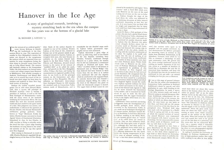
Section of 72 varves of Lake Hitchcock at West Lebanon which first gave the clue to the farther'north at Hanover.Emergence here of varves.
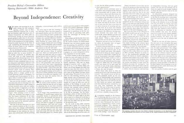
Prof. Goldthwait and Mr. Lougee in 1926, examining the sandy subsidence varve, 21 feet thick, in the bluff at Mink Brook, Hanover. When Lake Hitchcock subsided the brook spread sandy material over the lake floor.
Warren Upham '71 at the age of 81, on his return to Hanover for his 60th reunion in 1931. He is best known lor his studies of the world's greatest glacial lake which he named for Louis Agassiz, glacial theorist.
Professor Goldthwait and his first Geology 1 class on a field trip to Mink Brook, 1925.
RICHARD J. LOUGEE '27
Features
-
 Feature
How Green Is Squaw Valley
February 1960 -
 FEATURE
The Bird Listener
MARCH | APRIL 2024 -
 Cover Story
SOCHI HOPEFULS
JANUARY | FEBRUARY 2014 -
 Feature
How Do You Socialize a Freshman?
September 1993 -
 Feature
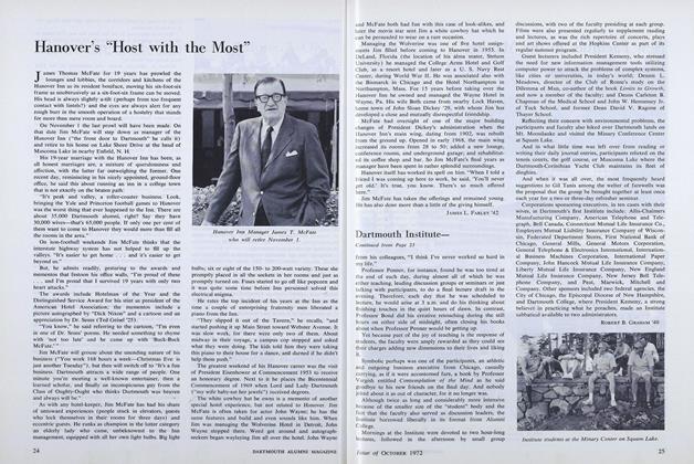
Hanover's "Host with the Most"
OCTOBER 1972 -
 Feature
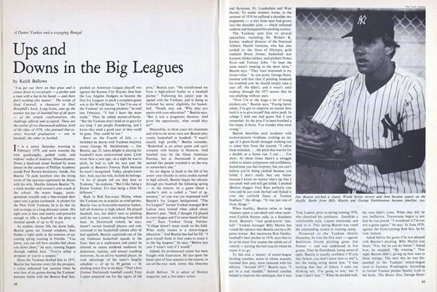
Ups and Downs in the Big Leagues
September 1979


