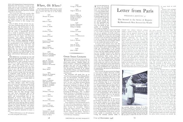
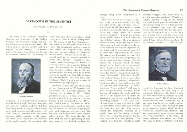
A TRAIL MAP FOR THE TRAMPER
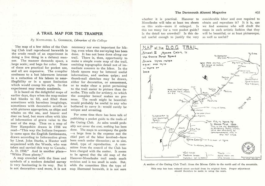
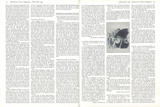
The map of a few miles of the Outing Club trail reproduced herewith is the crude result of an experiment in doing a live thing in a defunct manner. The manner demands space, a large scale; and begs for color. None of these are practical for pocket use, and all are expensive. The compiler confesses to a but lukewarm interest in a reduction of his labors to nearillegibility or in a space limitation which would cramp his style. So the experiment may remain academic.
It is based on the delightful maps of earlier days, days when the map-maker had blanks to fill, and filled them sometimes with harmless imaginings, sometimes with decorative scrolls or with pictures appropriate, as ships and whales on the sea, and beaver and deer on land, but more often with bits of information of grave value to the user of the map. Thus on a map of New Hampshire drawn in 1756 we read—"This way the Indians frequently came upon the English Settlements, drawn according to Information given by Lieut. John Starks, a Hunter well acquainted with the Woods, who was taken and carried this way to Canada; A. D. 1753." And in another place— "White Pines plenty."
A map crowded with the lines and symbols of a modern detailed survey is very fascinating in its way. But it is not decorative—and more, it is not necessary nor even important for hiking, even when the surveying has been done. It has not been done along our trail. There is, then, opportunity to make a simple route map of the trail, omitting topographic detail not of immediate concern to the hiker. In the blank spaces may be lettered useful information, and useless quips; and thumb-nail sketches may be drawn, either for decoration, or amusement, or to make clear a point pertaining to the trail easier to picture than describe. This calls for artistry, to which the compiler hereof makes no pretense. The result might be beautiful: would probably be useful to any who bothered to carry it: would surely be unique and arresting.
For some time there has been talk of publishing a pocket guide to the trails of the Outing Club. As sales would prob- ably not cover the cost, nothing has been done. The maps to accompany the guide —a large item in the expense and the chief part of the labor involved—have been much under discussion; as to size, detail, type of reproduction. A com- mittee from the council of the Club has been charged with the matter. It seems to be agreed that the old map of the Hanover-Moosilauke trail needs much revision and is too small in scale. But, while the committee likes the type of map illustrated herewith, it is not sure whether it is practical. Hanover to Moosilauke will take at least ten sheets on this scale—more if enlarged. Is this too many for a vest pocket guide? Is the detail too crowded? Is this detail useful enough to justify the very considerable labor and cost required to obtain and reproduce it? It it is, can we find someone who will draft the maps in such artistic fashion that they will be beautiful, or at least picturesque, as well as useful?
i_ : A section of the Outing Club Trail: from the Moose Cabin to the north end of the mountain. This map has been reduced about one-half from its original form. Proper adjustment should therefore be made in using the scale.
Librarian of the College

Nathaniel L. Goodrich
-
 Books
BooksMOUNTAIN CLIMBING GUIDE TO THE GRAND TETONS,
November 1947 -
 Article
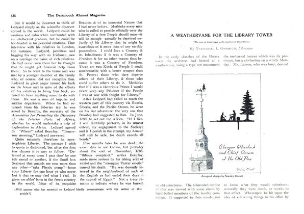
A WEATHERVANE FOR THE LIBRARY TOWER
MARCH, 1927 -
 Article
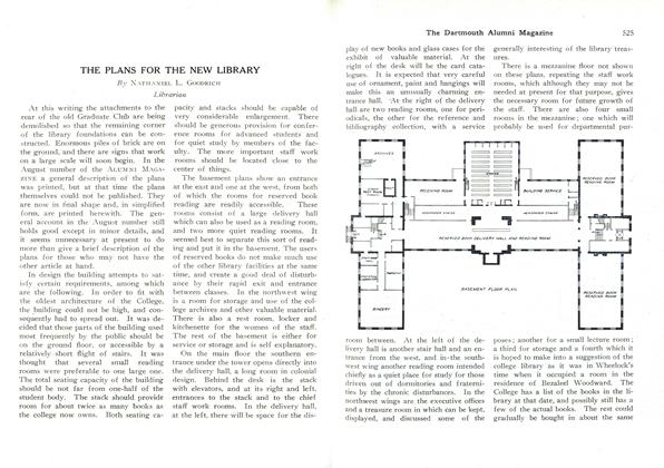
THE PLANS FOR THE NEW LIBRARY
APRIL, 1927 -
 Books
BooksTHE DARTMOUTH BOOK OF WINTER SPORTS
January 1940 -
 Article
ETTA M. NEWELL ASST. LIBRARIAN EMERITUS
May 1940 -
 Books
BooksMILLIONS OF BOOKS, THE STORY OF YOUR LIBRARY
July 1941