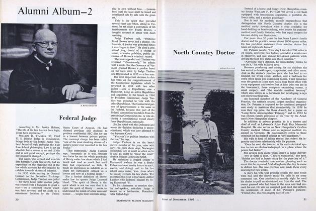
Moosilauke Area Doubled
MOUNT MOOSILAUKE weather conditions (not always at their best, as thousands of alumni will recall) were most accommodating on September 9, when relatives and friends of two donors of significant land acquisitions on the heights gathered at the Moosilauke Ravine Lodge to commemorate these helpful contributions.
First, the pages of history were rolled back to 1920 when the late Edward "Ned" K. Woodworth '97 of Concord, N. H., and his brother, Charles P. Woodworth '07 of New London, N. H., donated to the College the "circle tract" atop the summit including what was then known as the Prospect House. This was the historic structure that was manned as the Moosilauke Summit Camp by the Dartmouth Outing Club from that date until its loss by fire, probably a lightning strike, in 1942, when it became a war casualty in every sense of the word, as it will probably never be rebuilt in anything like its elegance of 1860.
Second, Penn Haile '24, whose knowledge and appreciation of Moosilauke and its satellites are probably surpassed by none, had the previous September finalized a long-discussed land transfer of some 1,179.6 acres, thereby increasing Dartmouth's total Moosilauke holdings to 2200 acres. His generosity made possible the inclusion of the East Peak and Jobildunc Ravine at the headwaters of Baker River, also the south face of the South Peak at Moosilauke.
Both are genuine outdoor laboratories for whatever uses the College's Departments of Biological Sciences, Earth Sciences and others may wish to make of them. The area up to the 4810-foot summit is a frequent subject for study by Dartmouth scientists. They have observed a range of vegetation and soil conditions in climbing to the summit than can be seen on level ground only by traveling 700 miles north.
The East Peak is an impressive shoulder of what has become generally known, but finally confirmed, as "Dartmouth's own mountain" (despite neighborly ownerships by Uncle Sam in the White Mountain National Forest, the Franconia Paper Corporation, and the Society for Protection of New Hampshire Forests near its Lost River Reservation).
Jobildunc Ravine is a true glacial cirque on the same contours, but somewhat smaller, than Tuckerman Ravine, Great Gulf, King's Ravine, and other examples of local glacial action among the higher terrain of the Presidential Peaks. The South Peak balances the East Peak and provides a rare view of both Moosilauke Summit and Mount Washington from the same vantage point.
Right there, on that same day in early September, a tablet was informally dedicated expressing the College's appreciation of Penn Haile's enthusiasm to acquire and protect for all time these rare pieces of New Hampshire upland real estate. He was on hand for the happy occasion.
Shortly thereafter, during that same memorable day on the summit of Moosilauke, another tablet was dedicated in recognition of the generosity of the Wood worth Brothers, who gave Dartmouth a "beach-head" atop the summit back in 1920. The daughter of the surviving brother, Sally Gallagher, was ,on hand to give her blessings and report back to her father.
All this didn't come about by accident. The Woodworth Brothers owned the summit tract to do with as they wished and its transfer to the College in 1920 was their desire. The Penn Haile transaction was somewhat more complicated as it involved agreement by the Franconia Paper Corporation as to sale price, accepted acreage, value of certain facilities within the tract, and growing wood budgeted as raw material for the mill in Lincoln.
However, Robert L. Marcalus, president of the corporation, agreed to this transfer - an exception to his policy of holding whatever timberland his corporation owned. Henry Waldo, woodlands manager, was most helpful throughout the long negotiations and with his assistant, Elwin E. Macomber, completed complicated surveys that included reestablishing the Benton-Woodstock town line from the Ravine Lodge to the height-of-land between Mount Jim and Mount Blue.
Thus, the College has a high-country laboratory second to none in the Northeast for its recreational, educational, and related activities.
Over the years Dartmouth has built a string of cabins in the area, the largest of which is the Moosilauke Ravine Lodge, built in the late thirties. Once an outstanding ski resort, its famous downhill run, "Hell's Highway," was the site of one of the first national downhill races. The coming of mechanized ski tows took skiing away from Moosilauke to the Skiway in Lyme, and Dartmouth closed the Lodge to the public in 1963.
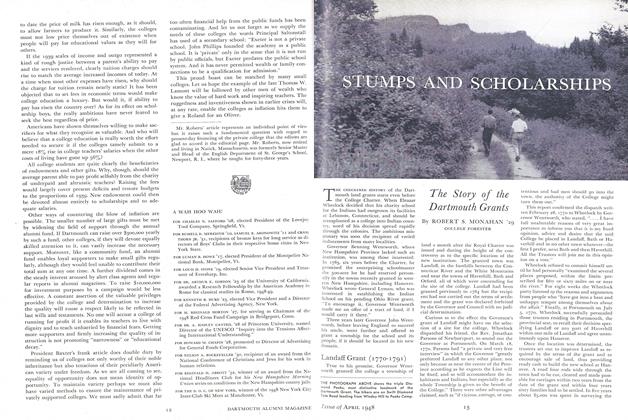
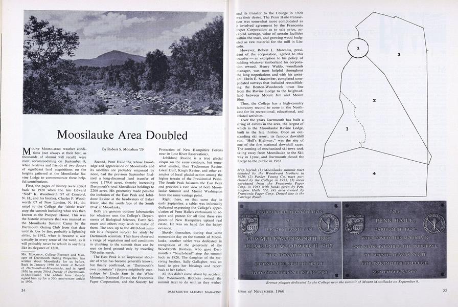
Map legend: (1) Moosilauke summit tractdonated by the Woodward brothers in1920; (2) Parker Young Co. tract purchased by the College in 1933; (3) areaspurchased from the Franconia PaperCorp. in 1965 with funds given by Pennington Haile '24; (4) area owned byFranconia Paper Corp. Dotted line is theCarriage Road.
Bronze plaques dedicated by the College near the summit of Mount Moosilauke on September 9.
Bronze plaques dedicated by the College near the summit of Mount Moosilauke on September 9.
MR. MONAHAN, College Forester and Manager of Dartmouth Outing Properties, has written about Moosilauke for us before. Back in January 1930 he wrote A Decadeof Dartmouth-at-Moosilauke, and in April 1950 he wrote Third Decade of Dartmouth-at-Moosilauke. The editors have already signed him up for a 50th anniversary article in 1970.